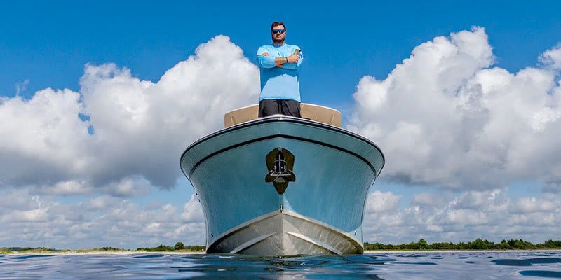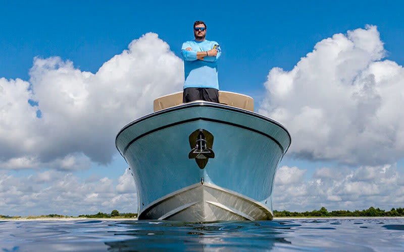


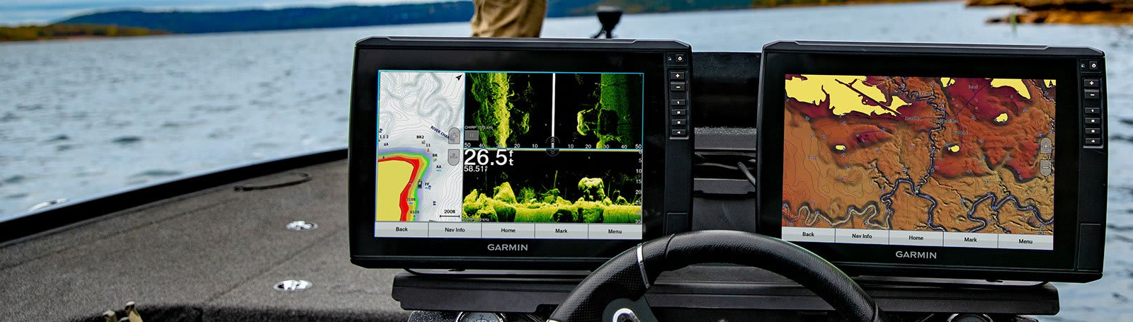
ALL THE TOOLS YOU NEED FOR SUCCESSFUL FISHING
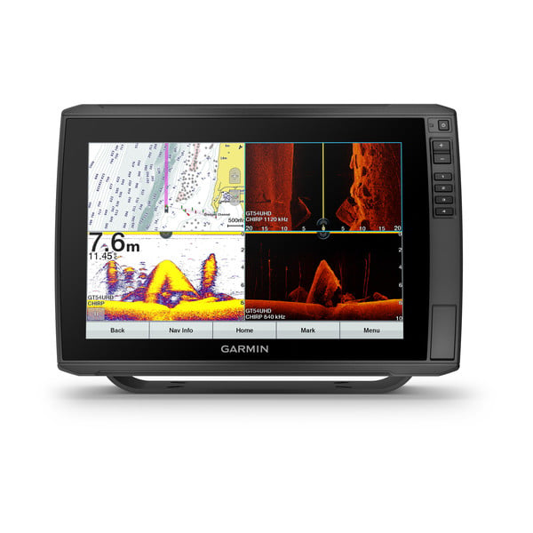
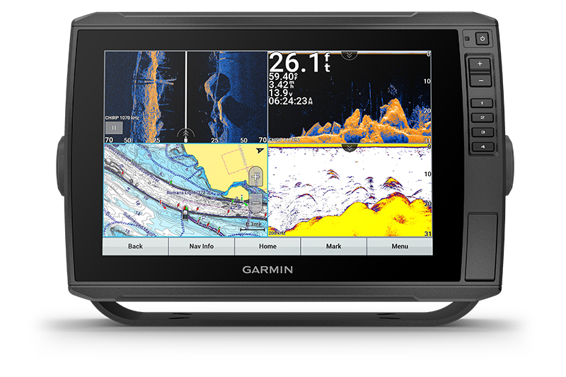
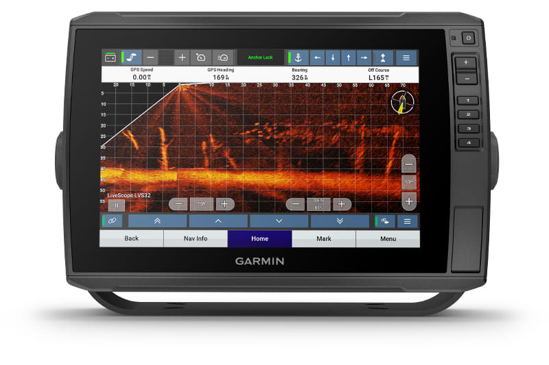
The sunlight-readable 12” touchscreen chartplotter/sonar combo features our worldwide basemap, and the transducer bundle adds CHIRP traditional and Ultra High-Definition scanning sonars.
The keyed-assist 12” touchscreen puts fishfinding know-how at your fingertips.
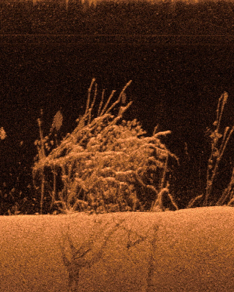
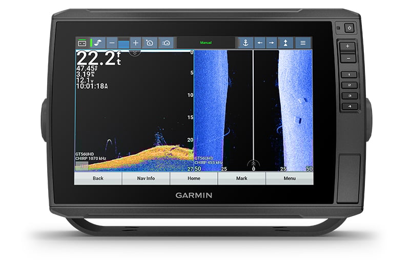
See crisp images of structure and fish in stunning detail.
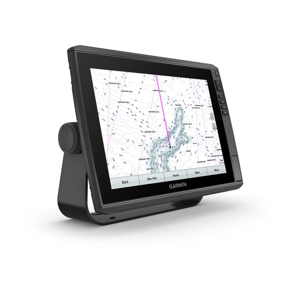
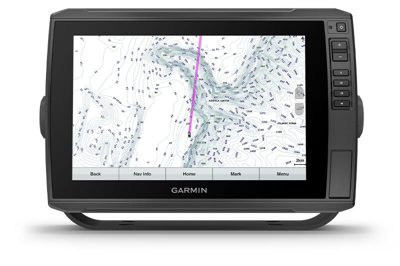
Navigate confidently with built-in Garmin Navionics+™ inland and coastal mapping.
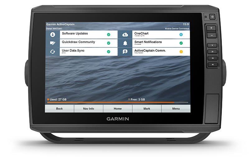
Manage your marine experience from nearly anywhere with the ActiveCaptain® app1.
Connect your boat to share data, sonar and charts with your other compatible devices.
Explore your new favorite spot; create maps on the fly, and tailor them to fit your needs.
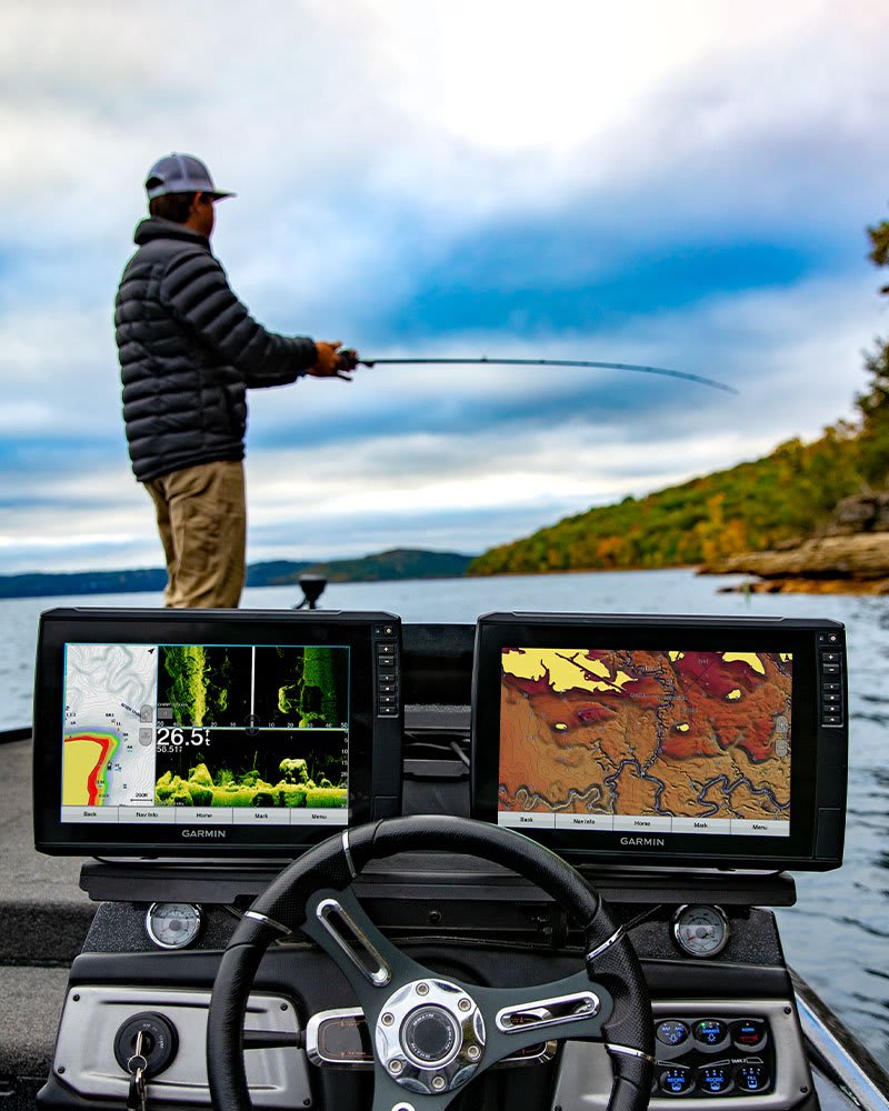
Better fishing comes built-in.
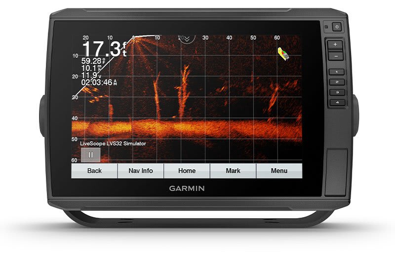
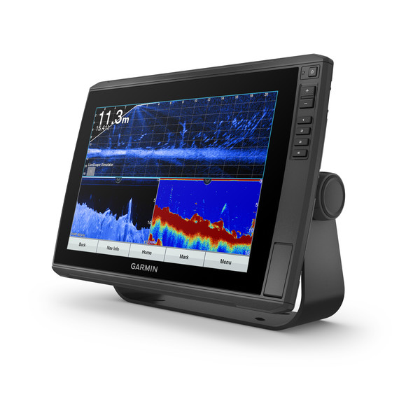
LIVESCOPE SONAR SUPPORT
ECHOMAP Ultra supports a variety of Garmin transducers (sold separately), including LiveScope all-seeing live sonar.
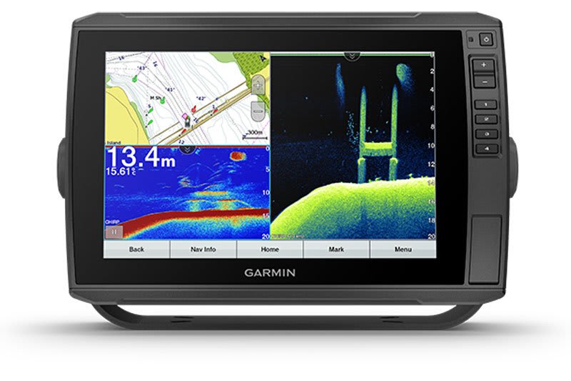
BUILT-IN UHD SONAR
Built-in UHD sonar provides Garmin CHIRP traditional sonar plus Ultra High-Definition ClearVü and SideVü scanning sonars when paired with a compatible UHD transducer. Transducer bundled products include the GT56 transducers with three scanning sonar frequencies and 20% greater range for your UHD SideVü sonar.
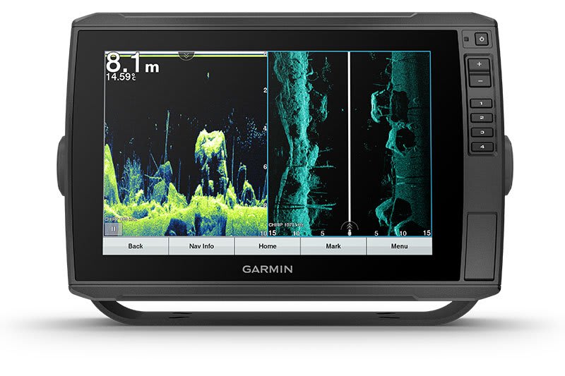
VIVID COLOR PALETTES
High-contrast vivid scanning sonar color palettes make it easier than ever to distinguish targets and structure.
ADD CHARTS
Experience unparalleled coverage and detail with optional Garmin Navionics+ integrated mapping or optional Garmin Navionics Vision+ premium mapping with high-resolution relief shading, satellite imagery, sonar imagery and more. They even come with a 1-year subscription for downloadable daily updates.
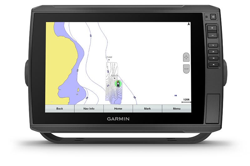
QUICKDRAW CONTOURS
Create personalized fishing maps on-screen with 1’ contours. Keep the data to yourself, or share it with the Garmin Quickdraw Community on the Garmin Connect app2.

Stay connected on and off the water.
NETWORK CAPABLE
If you have multiple compatible ECHOMAP Ultra 10” or 12” units or ECHOMAP Plus or UHD 7” and 9” units on your boat, you can share information — such as sonar, user data and charts — among them.
NMEA 2000 NETWORK COMPATIBILITY
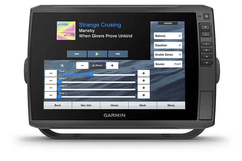
Connect to your compatible autopilots, digital switching, weather, Fusion-Link audio system, media, VHF, AIS, engine data, heading sensors — such as the SteadyCast sensor — and more from one screen.
ACTIVECAPTAIN APP
Built-in Wi-Fi connectivity pairs with the free all-in-one mobile app for access to the OneChart feature, smart notifications, software updates, Garmin Quickdraw Community data and more1.
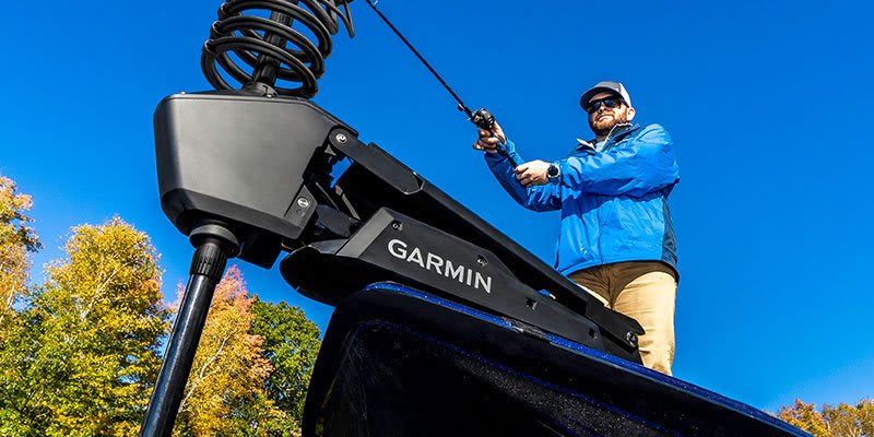
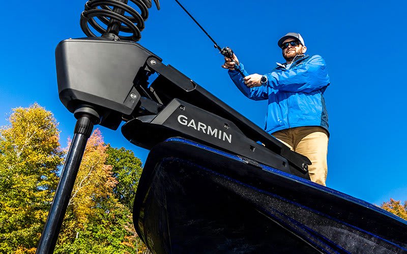
FORCE TROLLING MOTOR COMPATIBILITY
Take control of the most powerful and efficient trolling motor available3, route it to waypoints, follow tracks and more from the screen of your chartplotter.
POWER-POLE SHALLOW WATER ANCHOR
By networking select Garmin chartplotters with a Force trolling motor and your compatible Power-Pole shallow water anchoring system, you can access advanced boat control features4 from your plotter, including smart anchor auto-deployment, smart anchor jog, auto stow, anchor drag detection and auto guidance5 end-of-route anchoring. Spend more time fishing, less time positioning.
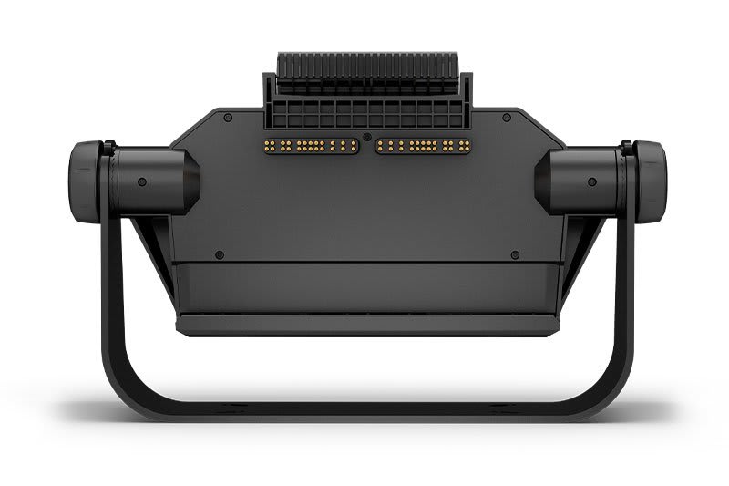
TAKE IT WITH YOU
Keep your ECHOMAP Ultra safe and secure. Cords plug directly into the quick-disconnect bail mount, which allows you to quickly install and remove your unit.