Skip navigation links

Buy now

Please purchase all our products from these authorized dealers only to ensure that you receive full support in Warranty and replacement matters.

ECHOMAP UHD2 5 Chartplotters

ECHOMAP UHD2 5 Chartplotters

Part Number 010-02589-03

SHOP ONLINE

ECHOMAP UHD2 5 Chartplotters ECHOMAP UHD2 5 Chartplotters ECHOMAP UHD2 5 Chartplotters ECHOMAP UHD2 5 Chartplotters ECHOMAP UHD2 5 Chartplotters

WHY TALK TO A LOCAL WHEN YOU CAN FISH LIKE ONE?

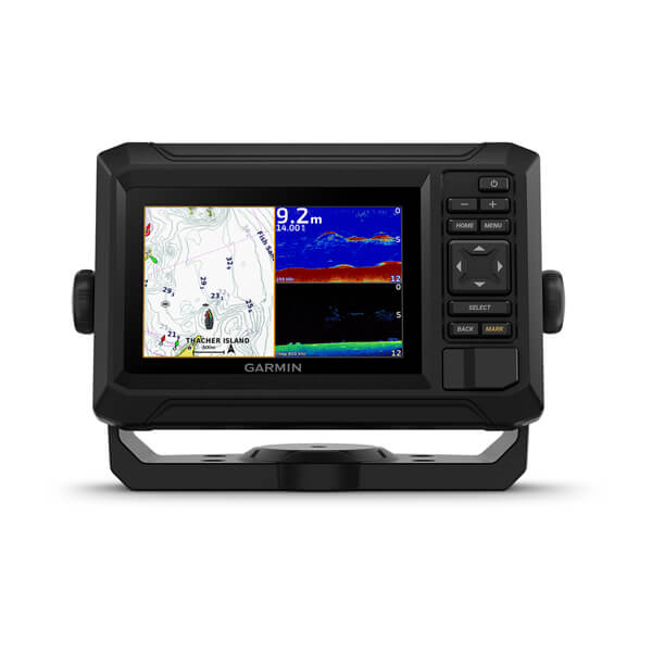
They say locals know best. But anyone who says that hasn’t fished with the ECHOMAP UHD2 5” chartplotters with clear, crisp sonar and mapping.

The bright 5” keyed display is made for convenience.

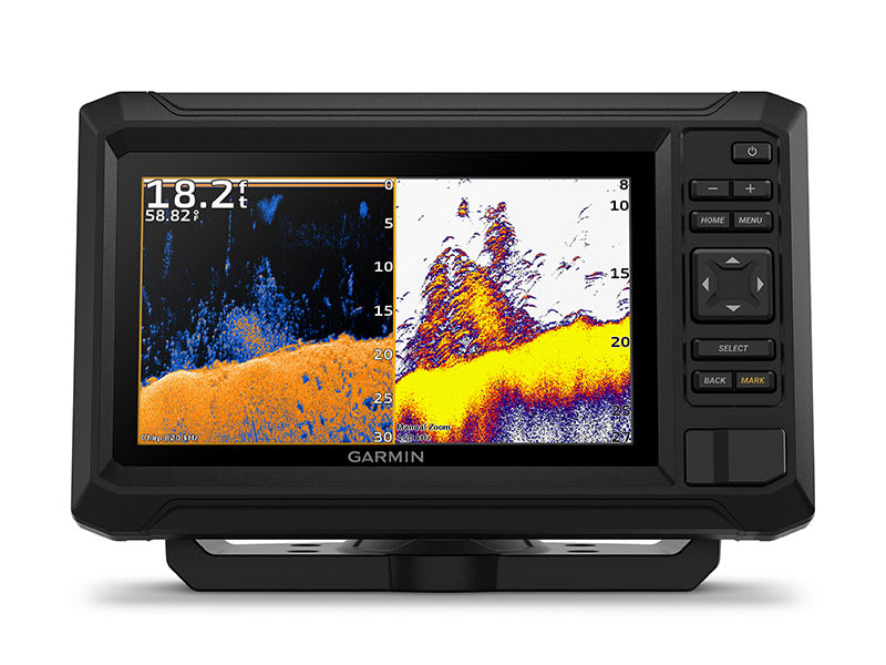
Get double the views1 with Garmin CHIRP traditional and ClearVü scanning sonars.

What’s under the water looks even better with high-contrast vivid color palettes.

Enjoy No. 1 in mapping3 with our LakeVü g3 and BlueChart® maps with Navionics® data.

Know the waters, catch more fish.
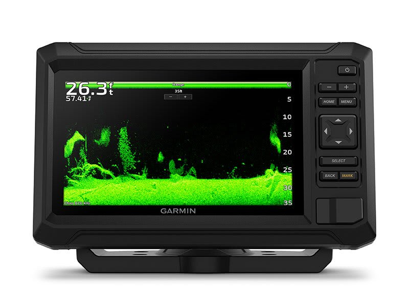
SONAR SUPPORT

With crisp, clear traditional sonar and brilliant ClearVü sonar, the fish will have nowhere to hide.

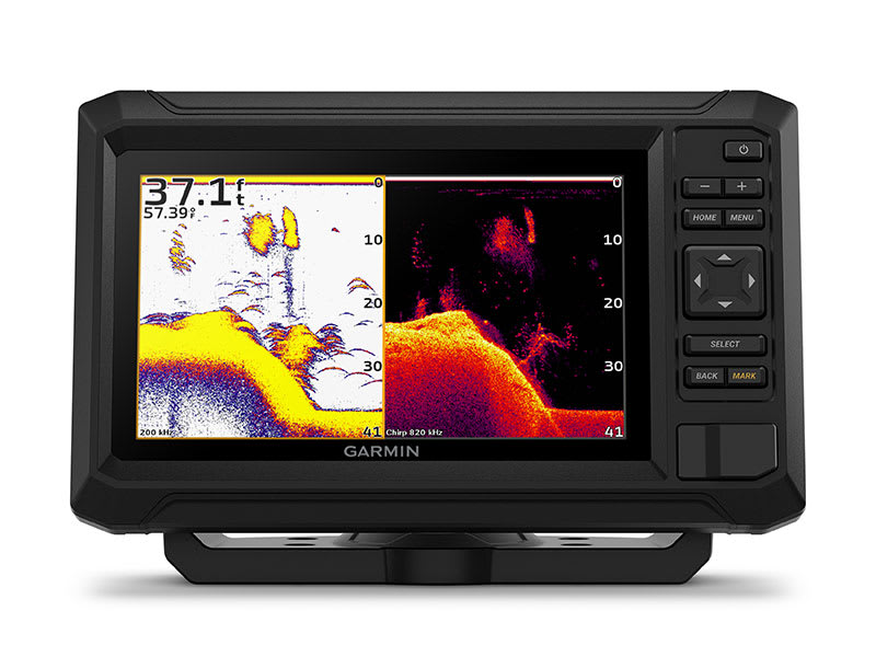
VIVID COLOR PALETTES

High-contrast vivid scanning sonar color palettes make it easier than ever to distinguish targets and structure.

BUNDLE YOUR TRANSDUCER

Your ECHOMAP UHD2 device supports a variety of Garmin transducers for two types of sonar: Garmin traditional and ClearVü scanning sonars.

General

Dimension7.4" x 4.8" x 2.4" (18.8 x 12.2 x 6.2 cm)
Weight

1.1 lbs (0.5 kg)

Waterproof

IPX7

Display TypeWVGA, IPS
Display Size4.3" x 2.6" (10.9 x 6.6 cm)
Display Resolution800 x 480 pixels
Mounting OptionsBail or flush
Input 

Maps & Memory

Accepts Data Cards

1 microSD™ card; 32 GB maximum size

Waypoints

5,000

Track points50,000
Tracks50 saved tracks
Navigation Routes100

Sensors

GPS 
Galileo 
Has built-in receiver 
Receiver

5 Hz

Supports WAAS 

Built-in Maps

Built-in Auto Guidance+yes (downloadable via ActiveCaptain app)
Garmin Navionics+ Inland & Coastalyes (see Additional)
Garmin Navionics+ (Coastal)yes (see Additional)
Garmin Navionics+ (Inland)yes (see Additional)

Optional Map Support

BlueChart g3 
BlueChart g3 Vision 
LakeVü g3 
LakeVü g3 Ultra 
Garmin Navionics+™ 
Garmin Navionics Vision+™ 
TOPO 100K 
Standard Mapping 
Garmin Quickdraw Contours 

Chartplotter Features

ActiveCaptain® compatibleyes

Electrical Features

Power Input9 to 18 Vdc
Typical current draw at 12 Vdc1.0 A
Maximum current draw at 12 Vdc1.5 A
Maximum power usage at 10 Vdc18W

Sonar Features

Displays sonar 
Power output500 W
Traditional sonar (dual frequency/beam)built-in (single channel CHIRP, 50/77/83/200 kHz, L, M, H CHIRP)
ClearVübuilt-in 260/455/800/1000/1200 kHz

Connections

4-pin transducer ports1

Additional

Additional

no

With Transducer

  • ECHOMAP UHD2 (device varies depending on selection)
  • GT20-TM transducer
  • Power/data cable
  • Tilt mount
  • Flush mount
  • Hardware
  • Documentation

Without Transducer

  • ECHOMAP UHD2 (device will vary depending on selection)
  • Power/data cable
  • Tilt mount
  • Flush mount
  • Hardware
  • Documentation

Loading

Loading